Page 1 of 1
Where am I please Ms Virgin?
Posted: 30 August 08 10:08 pm
by TeamAstro
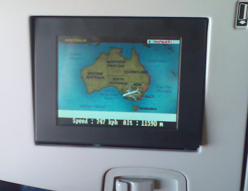
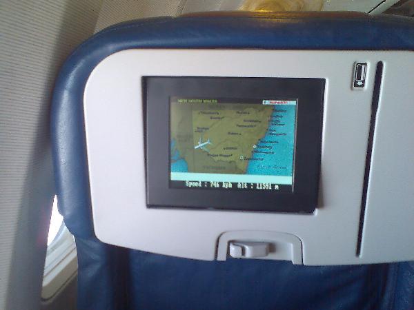
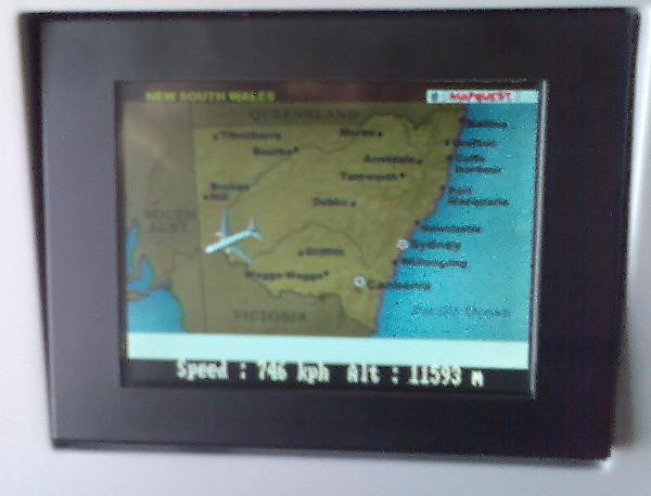
We have all played with our GPSr's on planes. It works best if you sit near the window. I was flying back with VirginBlue from the Gold Coast to Adelaide a couple of weeks ago, and I couldn't be bothered getting my unit out so I tuned in to the in-flight map service. (pics below).
One problem. I couldn't tell where I was. Can you? What part of the plane signifies my position? .... I turned on my unit and confirmed the speed and altitude. But where was I?
Note, sometimes the display shows a really big plane. Other times really small. Don't think it's relativistic length contraction though...

CLear skies, Astro.

so help on this please..
Posted: 30 August 08 11:30 pm
by Richary
I noticed the same on a recent work trip to Melbourne. And I couldn't work it out either. Sometimes it seemed to be the middle of the plane when I could identify landmarks but on other views seemed to be the nose. I think the only way to tell would be to watch it prior to takeoff when you know exactly where you are. <p>Don't know why the flight takes so long when on some views Melbourne to Sydney only involves walking the length of the plane!
Posted: 31 August 08 1:26 am
by Damo.
I switched on my Nokia 6110 on a recent flight. (in offline mode of course!) I was still trying to be quiet about it though as I didn't want to have to explain to a flight attendant that no I wasn't using the mobile phone etc. Took a while to get a lock and when it did the speed alarm I had programmed for 120km/h+ certainly made itself known! whoops.
Posted: 31 August 08 10:17 am
by Dik:
As you can see from the pics, the map zooms in and out, whenever it chooses, not when you choose.
I first came across this feature a couple of years ago on a trip to the USA on Qantas. Once you are in the middle of the Pacific the zoom in map becomes pretty useless as it's alll sea. The zoom out picks up some land so you can tell how far across the ocean you are. There is a third zoom level that shows the whole world and what parts are day & night. Virgin seem to have disabled this. Similarly headed to Singapore earlier this year the zoom out helps me locate myself when in unfamiliar parts of the world.
Just be thankfull Virgin don't make you swipe your credit card to watch.
Posted: 31 August 08 10:54 am
by Spruce Mooses
The Qantas one is really good when it goes into Zoomed in mode, you can definitely make out what town you are flying over.
However, a window seat with the Garmin works so much better

Posted: 31 August 08 1:53 pm
by Boagsratz
Most odd, I have not tried it out, but was under the impression that most units had a disable feature that rendered them useless above a certain speed/altitude, so as the units could not be used in guidence systems for less savoury activities....or is this an urban myth?
Re: Where am I please Ms Virgin?
Posted: 31 August 08 2:52 pm
by Rabbitto
TeamAstro wrote:One problem. I couldn't tell where I was.
<p>So I have to ask. On the need to know your exact position, were you planning on hopping out for a couple of minutes for a quick cache?
Posted: 31 August 08 4:59 pm
by Geof
Boagsratz wrote:Most odd, I have not tried it out, but was under the impression that most units had a disable feature that rendered them useless above a certain speed/altitude, so as the units could not be used in guidence systems for less savoury activities....or is this an urban myth?
My yellow etrex worked at >800km/h @ 14000+ feet
I found the in flight data on the screen was considerably "damped". The etrex showed the little ups and downs.
Posted: 31 August 08 7:03 pm
by CaleD
Boagzratz, I think you're referring to the Selective Availability feature that the GPS satellites have on board. From memory, when someone at GPS-HQ presses a button, the satellites start broadcasting random distance errors to throw people off. But this system was permanently disabled a while ago.
Posted: 31 August 08 9:22 pm
by zactyl
Geof wrote:Boagsratz wrote:Most odd, I have not tried it out, but was under the impression that most units had a disable feature that rendered them useless above a certain speed/altitude, so as the units could not be used in guidence systems for less savoury activities....or is this an urban myth?
My yellow etrex worked at >800km/h @ 14000+ feet
I found the in flight data on the screen was considerably "damped". The etrex showed the little ups and downs.
Yellow Etrex as well, I didn't have any in flight data, but was quite impressed when I looked at the track log from my Sydney to Gold Coast flight. Once the plane got up there, there was absolutely no change in speed, direction or altitude until the descent for landing.

Posted: 01 September 08 1:21 am
by Boagsratz
Makes me most curious to try it out next time I travel by plane...not that I have any tubular-shaped object out in the shed!!!!
Posted: 02 September 08 10:00 pm
by Geo Busters
I think your position is the point where the front edge of the wings meet the fuselage - at least on the Virgin version. I recently did a trip from Melbourne - Hobart and Launceston - Melbourne and checked it as we crossed the coastline, same point both times.