
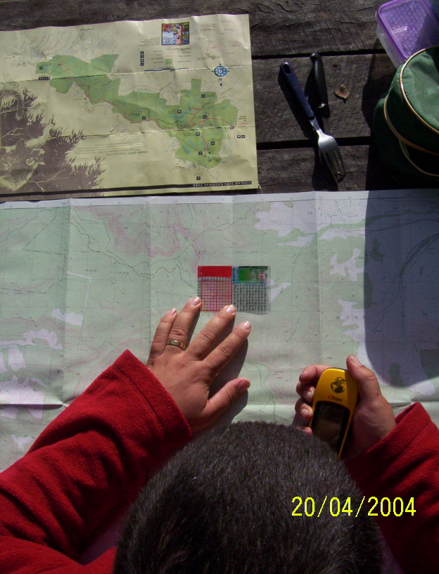
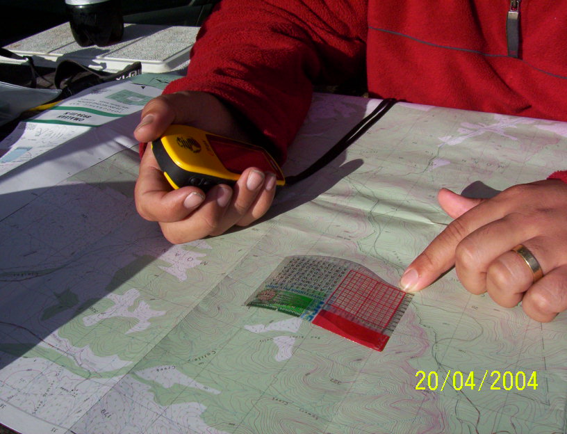
While trying to pick a location in Coolah Tops this week Bronze and I got much enjoyment from:<br>
1. finding a spot on a topo<br>
2. using a little toy steelrat gave us to work out the UTM of the loc<br>
3. putting that into our gps <br>
4. finding we got it spot on<br>
We even found were we were on the map and were exited to see the hight on GPS and map matched.
<img src="http://img.groundspeak.com/cache/ea9d0e ... d21b6e.jpg ">
A simple pleasure really, using the map and GPS together.
Team Pi even found their first cache with just a topo, it would be an interesting challenge to try it but I think IÂ’m fall back on the eTrex.
Using maps


-
swampgecko
- It's all in how you get there....

- Posts: 2185
- Joined: 28 March 03 6:00 pm
-
Gunn Parker
- 400 or more spectacular views seen

- Posts: 1357
- Joined: 08 April 03 1:14 pm
- Location: Perth Western Australia
- Contact:
Well the gizmo in the picture is just a plain one that gives a grid for working out the UTMs to 50 meters on 1:25000 scale maps topos and street directories, but Steelrat also made one that has to grids overlayed to convert AGD66 to WSG 84 and WSG84 to AGD66, it also tells you which datum the different series of maps are in. most 1:25000 topo and street directories are in AGD66. I guess you can get one from Steelrat thatÂ’s were we got them.


Actually your right - the most amount of map work I got to do was for myself on weekend. Usually the Boss did all the navigation and we just counted the creeks and hills as they came and went.
The most serious amount of map work I got to do though was when I had a six month stint salvage diving. You earn your dollars then. We were doing a clean up of the Barrier Reef - Sound beaufiful eh! Trust me, if you ever want to kill a wonderful hobby, take it on as a job. Anyhow it was marine charts to each location and then we had to map our paths underwater so we didn't miss any areas that were specified in the salvage operation. We dived often four times a day spending up to an hour and a half under water. It was shallow so nitrogen levels were never a concern. Did a few deep dives and night dives - the latter mostly for recreation. Chemical drums in deep water were often what we needed to do the most mapping for. Didn't find any bodies, that what everyone asks but scored a couple of motorbikes, 12 pushies and about 7km of fishing line. Gave up counting stubbies and tins.
The Bronze.
Well, after a heads-up from Mix76 about his flagrant display of secret rat technology, I have decided to advise of the following:
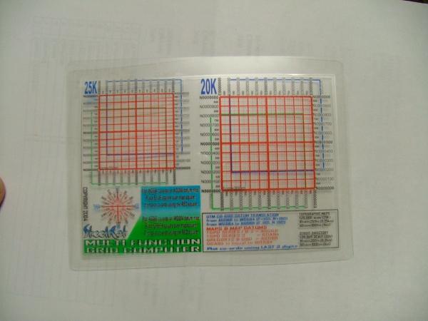
-The bit of gear in the picture is the decoder card given to all participants in the March Maitland Cache Event. Apart from the decoding bits, it also had a grid specifically designed for use on topo maps at 1:25000 scale.
-The super whoopee version that auto offsets WGS84 to/from AGD66, on both 1:25000(topo) and 1:20000(directory) scale maps is a bit bigger (a6 size) and is properly laminated for durability. Bronze and Mix got one to stop them drooling all over the barbeque table.
-Both types were created using the CORELDRAW graphics program, and printed onto sheets of transparency (as in overhead projector) using a bubblejet printer. They are not waterproof unless you laminate them.
-If I knew how to post an image to show you the super whoopee version on this forum I would.
-If anyone wants an e:mailed copy of the CORELDRAW file, send me an e:mail to thesteelrat@hotmail.com, with appropriate begging and pleading, and it shall be yours.
-I can try sending JPEG versions to those without CORELDRAW, but I don't know how the sizing will translate, and the size DOES matter.
<img src="http://img.groundspeak.com/cache/log/46 ... 9389fa.jpg">If I knew how to post an image to show you the super whoopee version on this forum I would.
