2017/2018 Summer Game
-
caughtatwork

- Posts: 17024
- Joined: 17 May 04 12:11 pm
- Location: Melbourne
- Contact:
Re: 2017/2018 Summer Game
This is not a dZ game. It is state vs state regardless of clan.
-
whitewebbs

- 6500 or more caches found

- Posts: 358
- Joined: 05 February 11 6:39 pm
- Location: Sandford
Re: 2017/2018 Summer Game
Can you claim as many scavenges as you like each day if you can locate them or are you limited to one only per day.
Note. I think it is as many as you like if I remembet from the last summer games.
Note. I think it is as many as you like if I remembet from the last summer games.
Last edited by whitewebbs on 16 December 17 2:33 pm, edited 1 time in total.
-
Now_To_Morrow

- 3500 or more caches found

- Posts: 724
- Joined: 08 January 09 8:55 pm
- Location: Australia
- Contact:
Re: 2017/2018 Summer Game
Altitude question... Is there a certain map or something that GCA have based their altitudes off that we can access to plan ahead where to hide caches? I have a small window of opportunity to venture into other altitudes and would like to plan ahead rather than take a stab in the dark and hope I hid it in the right place. Or does anyone have a clearly marked map they have found? I can find changing colour scale ones on the internet but they are so hard to define.
Online
-
J_&_J

- Posts: 1264
- Joined: 12 May 05 7:58 pm
- Facebook: https://www.facebook.com/profile.php?id=100000016368307
- Location: Morphett Vale
- Contact:
Re: 2017/2018 Summer Game
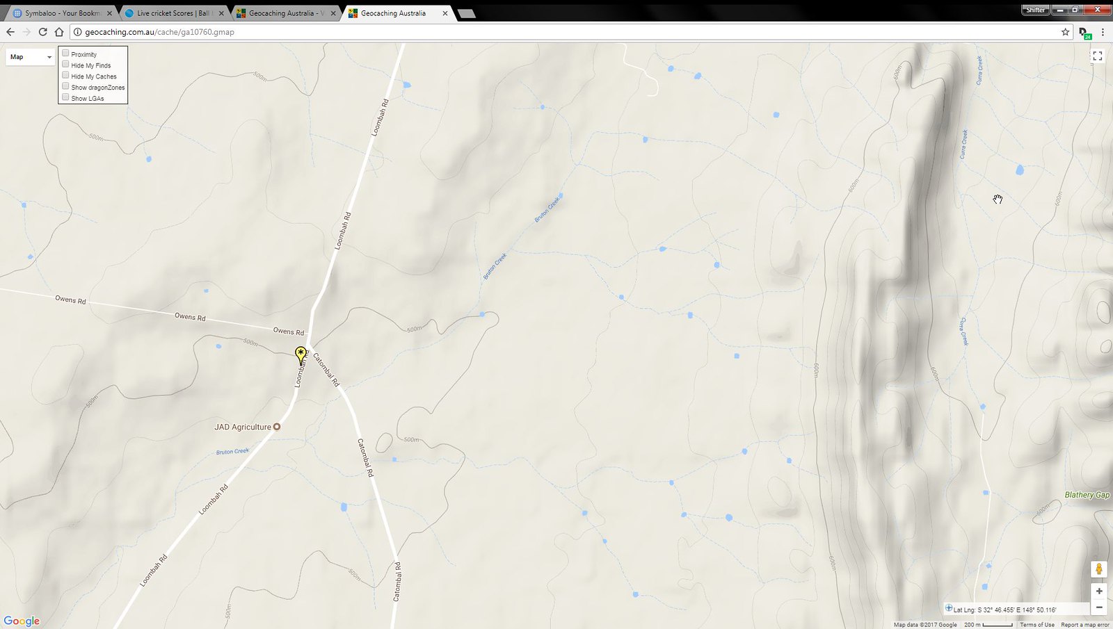
I'm not sure how GCA et their altitude data, but I suspect it's from Google, as I know GSAK can get altitude data for geocaches via Google.
If you look at an existing cache page that's in the vicinity of where you might like to hide your cache, you cab then click on the map for that cache and turn on Terrain. For instance, looking at your cache ga10760 ( http://geocaching.com.au/cache/ga10760.gmap ), by clicking on the map on the cache description page, and ticking the terrain checkbox in the upper right hand corner, will display the map like this:
https://farm5.staticflickr.com/4547/390 ... 6508_h.jpg
This level of zoom is as close as you can zoom in before the terrain rings disappear, but it shows elevations at every 20 metres ASL.
You could also create a new cache listing, and just keep it in draft status. You could then play around with likely coordinates and save the listing, allowing you to view the elevation when you view the listing page.
Online
-
CraigRat

- 850 or more found!!!

- Posts: 7015
- Joined: 23 August 04 3:17 pm
- Twitter: CraigRat
- Facebook: http://facebook.com/CraigRat
- Location: Launceston, TAS
- Contact:
Re: 2017/2018 Summer Game
We get our height data from the google maps API.
Re: 2017/2018 Summer Game
If you're on reddit, please upvote https://www.reddit.com/r/geocaching/com ... he_nation/ for greater visibility around the world!